
Footpaths
Descriptions of Footpaths in the Parish
Below are listed descriptions of footpaths in the parish. You can also download details of a suggested walk entitled 'A walk on the quiet side - sheltered and not too strenuous'. Please note that our new permissive footpath, Finnygook Way is now open.
Interactive Map
To view an interactive map, visit the Cornwall Council website which has a link to a Public Rights of Way Interactive Map
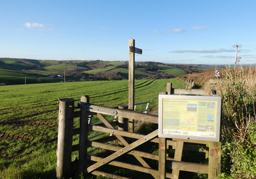
Footpath No 1
From Footpath No 2 to the River Lynher. First part on road second part on track. Second part difficult in places because of erosion, but the views of the estuary, particularly at high tide, make the effort worthwhile. Length 930m.
Footpath No 2
From A374 (take lane at rear of church) to Footpath No 1. Easy walk. Length 150m.
Footpath No 3
From Finnygook Lane opposite the entrance to the Hotel, to the East of Blackball. East walk but steep at the start. Lengh 1,300 mts. The extension of footpath 3 to Tregantle Fort and beyond is a permissive path across MOD property and is not available when red flags are flying. Use footpath 11 when the red flags are flying. The short permissive path to Blackball beach is steep and can be slippery when wet. Access to Blackball beach is restricted when red flags are flying.
Footpath No 4
From Trewrickle Lane to Finnygook Lane. Steep in places but generally an easy walk. Length 700m. Take extreme care when crossing the B3247.
Footpath No 5
From Crafthole opposite rear of Finnygook Inn to Lady Well. Easy walk but steep for first 50m and can be muddy along last section. Length 1,240m.
Footpath No 7
From Finnygook Lane below Burns View to Black Ball Cliff at junction with Coastal Path. Easy Walk. Length 350m.
Footpath No 8
From road north of Tredis House to A374 north east of Sconner Farm. Easy walk. Length 1575m.
Footpath No 9
From Tregenna to Trewrickle Lane. Easy walk. Length 510m.
Footpath No 10
From Portwrinkle to Parish Boundary north of Britain Cove. Coastal Path. Steep sections. Length 850m.
Footpath No 11
From east Black Ball Cliff to Parish Boundary to west of Tregantle fort. Coastal Path. Easy walk. Length 680m.
Footpath No 12
From Finnygook Lane to Finnygook Beach. Length 110m. Easy walk but steep.
Footpath 13
This is a new footpath opened in April 2015. It starts from below Tredis View in Crafthole and inside the field side follow the B3247 to the junction with Trewrickle Lane. Trewrickle is very lightly trafficked and by turning left along the lane it can be followed for about half a mile to an existing footpath, No 4 (Sanders Lane), which can be followed until just before it meets the Downderry Road, where the second part of the new footpath will, by turning left into it, take you back to Crafthole by Carew Close.
This is an easy circular walk of about 2.5 km.
The path links with
- Horsepool Lane a lightly trafficked Road to Sheviock,
- to Footpath No 9 at Tregenna and then via lightly traffic roads to Tredis and on to Footpath No 8 to Sconner Farm
- Donkey Lane, another lightly trafficked road to Portwrinkle, by continuing along Trewrickle Lane to the Downderry Road or,
- by continuing along Sanders Lane, Footpath No 4 over the Downderry Road also to Portwrinkle arriving by the Whitsand Bay Hotel.
From Portwrinkle take the coastal path and Footpath No 7.
Footpath Extension to Circular footpath 13, "Amber's Way".
"Amber's Way" is a new permissive footpath to link with the hamlets of Polscoe, Tredis and Tredossal.
Top Notice Board Description:
This new permissive footpath extension "Ambers Way" links circular walks within the parish without having to walk on busy roads. Follow this path downhill approx. 200 meters with the options to then:
- Turn left onto the unnamed road, then left again towards Tredossel. Continue past Tredossel farm and at Tregenna farm turn left onto footpath no 9, which re-joins to Trewickle Lane. If you turn left onto Trewickle Lane it will lead you back to this point after approx. 500m. However, if you turn right onto Trewickle Lane, after 200m approx. you can then join footpath no 4, Sanders Lane. This can lead to the circular footpath no 13 back to Crafthole or alternatively you can continue across the Downderry road (with great care) along footpath no 4 down to Portwrinkle.
- Turn left, then Right towards Tredis. From the road north of Tredis House you can link to footpath no 8.
Northern Base Notice Board Description:
This new permissive footpath extension "Ambers Way" links circular walks within the parish without having to walk on busy roads. Follow this path uphill approx. 200 meters with the options then to:
- Continue across Trewickle Lane to re-join the circular footpath no 13 up to Crafthole, which eventually provides links to the coastal path, footpath no 5, or continuation of circular footpath westward 13 and footpath no 4
- Turn right into Trewickle Lane, after approx. 500m on a sharp left bend, turn right onto footpath no 8, this goes to Tregenna, which can link onto the quiet lane to Polscoe to eventually re-join this circular extension "Ambers Way", here at the bottom north end, or to Tredis and ultimately on a further existing footpath no 8 at Sconner farm.
- Turn right onto Trewickle Lane, which is very lightly trafficked. After about 700m turn left to an existing footpath no 4, called Sanders Lane. Follow the path to where it crosses the Downderry Road. Just before the road turn left into the second section of new footpath, which comes back to Crafthole, then head to Tredis View to re-join circular 13 north West back to Trewickle Lane. Alternatively, access Portwrinkle by continuing along Sanders Lane footpath no 4, after carefully crossing the Downderry Road, this leads to Portwrinkle. To return to Crafthole from Portwrinkle take the coastal path to the start of the golf course and at the direction post turn left.
- By turning Left when reaching Trewickle Lane and crossing the main road with care and continuing along Horespool lane, gives access to Sheviock.